 Description
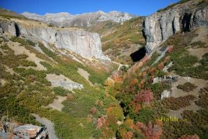
: Dry Canyon provides many stunning views and access to spectacular trails in every direction. Hike up the the dramatic cliffs ("The Great Blue Gate" named for the cereulian blue limestone), then turn left along the
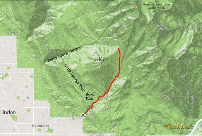
Curly Springs Trail, or later the Bowl Trail; turn right and follow the Curly Springs Trail south till it joins dozens of trails just inside Provo Canyon; or continue on up to climb Baldy (either by the standard route up Dry Canyon or take the steep
Southwest Ridge). From the Baldy shoulder, head north or south along the Great Western Trail, or leave the trail and strike up Everest Ridge (which requires stamina and mountaineering skills and know-how, especially if it still has snow).
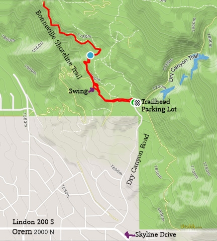
From the trailhead, you can also take the Bonneville Shorline Trail to the north or south, and many other excellent biking/hiking trails cover the nearby foothills.
Distance: 3 miles
Elevation gain: 3,000'
Steepness: somewhat steep much of the way.
Notable Features: Great Blue Gate cliffs.
Amenities: Pit toilet, paved parking lot.
Fees: None.
When to go: Late spring through late fall.
Directions: Drive up Orem 2000 North (aka Lindon 200 South) until it begins to curve into Skyline drive. Turn northeast up Dry Canyon Drive to the parking lot trailhead.
Mountains, lakes and other features accessed: Baldy, Everest Ridge.
Connecting & cross trails: Bonneville Shoreline Trail, Great Western Trail, many other trails.
Download GPX:


 Description: Dry Canyon provides many stunning views and access to spectacular trails in every direction. Hike up the the dramatic cliffs ("The Great Blue Gate" named for the cereulian blue limestone), then turn left along the Curly Springs Trail, or later the Bowl Trail; turn right and follow the Curly Springs Trail south till it joins dozens of trails just inside Provo Canyon; or continue on up to climb Baldy (either by the standard route up Dry Canyon or take the steep Southwest Ridge). From the Baldy shoulder, head north or south along the Great Western Trail, or leave the trail and strike up Everest Ridge (which requires stamina and mountaineering skills and know-how, especially if it still has snow).
From the trailhead, you can also take the Bonneville Shorline Trail to the north or south, and many other excellent biking/hiking trails cover the nearby foothills.
Distance: 3 miles
Elevation gain: 3,000'
Steepness: somewhat steep much of the way.
Notable Features: Great Blue Gate cliffs.
Amenities: Pit toilet, paved parking lot.
Fees: None.
When to go: Late spring through late fall.
Directions: Drive up Orem 2000 North (aka Lindon 200 South) until it begins to curve into Skyline drive. Turn northeast up Dry Canyon Drive to the parking lot trailhead.
Mountains, lakes and other features accessed: Baldy, Everest Ridge.
Connecting & cross trails: Bonneville Shoreline Trail, Great Western Trail, many other trails.
Download GPX:
